Researching Local History with Maps
As a historian, I believe maps are one of the greatest sources of information, capturing a time and place. We use these maps to research history and find buildings, families, farms, or streets. We often compare those historic maps to current maps. Then, we go on a journey to find that actual location today. Once in a while, we take our research and create maps to give perspective. #readytoremember.
Want a Historic Map of one of 5 towns in the Somerset Hills?
Click one of the maps below to find out how to get one.

Mr Local History Google Research Maps


Digital Maps – New Jersey
 | Princeton University New Jersey Map Collection 1666-1888 |
 | NEW JERSEY 1873 Color |

| New Jersey 1814 Color Map |
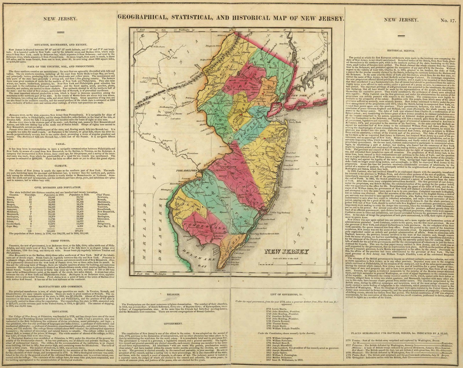
| Carey’s 1822 Geographical, Historical and Statistical State Map of New Jersey |
 | NEW JERSEY GEOLOGY – 1868 |
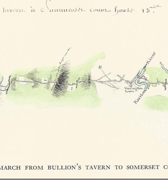
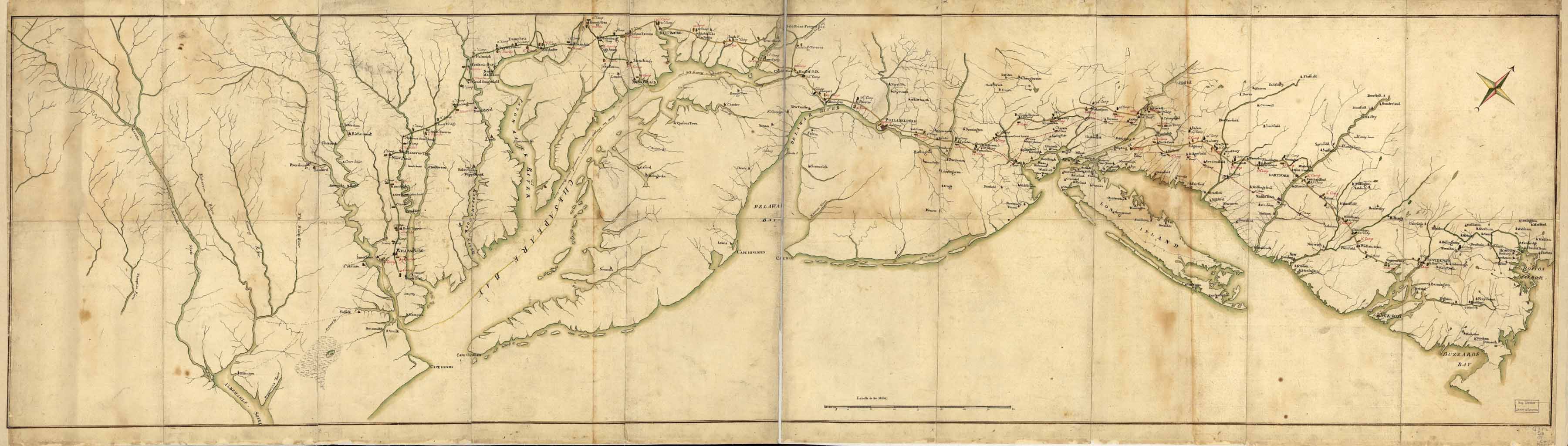 | The Rochambeau March Map – 1782 |
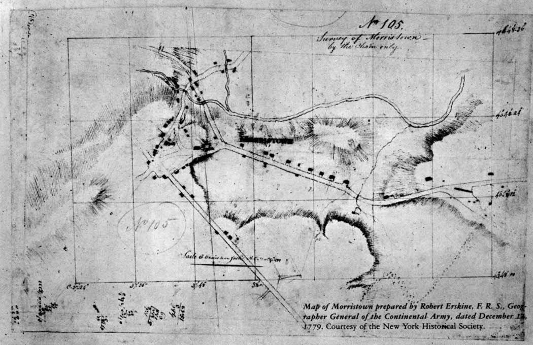
| Morristown 1779 – Robert Erskine, F. R. S., the Surveyor-General of the Continental Army |
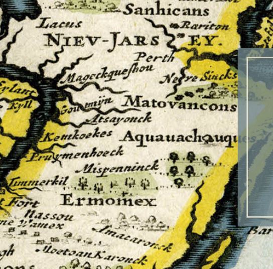
| Map Geeks | Collection of historic digital Maps of New Jersey Jeffery’s 1776 Map of the Provinces of New York and New Jersey with part of Pennsylvania Carey’s 1795 State Map of New Jersey Compiled from the most Authentic Information Arrowsmith’s 1804 State Map of New Jersey Carey’s 1814 State Map of New Jersey Carey’s 1822 Geographical, Historical and Statistical State Map of New Jersey Finley’s 1827 State Map of Delaware, New Jersey and Pennsylvania Tanner’s 1836 State Map of New Jersey Colton’s 1856 State Map of New Jersey Mitchell’s 1880 State, County and Township Maps of New Jersey, Maryland and Delaware |
Digital Paper Maps – Somerset County
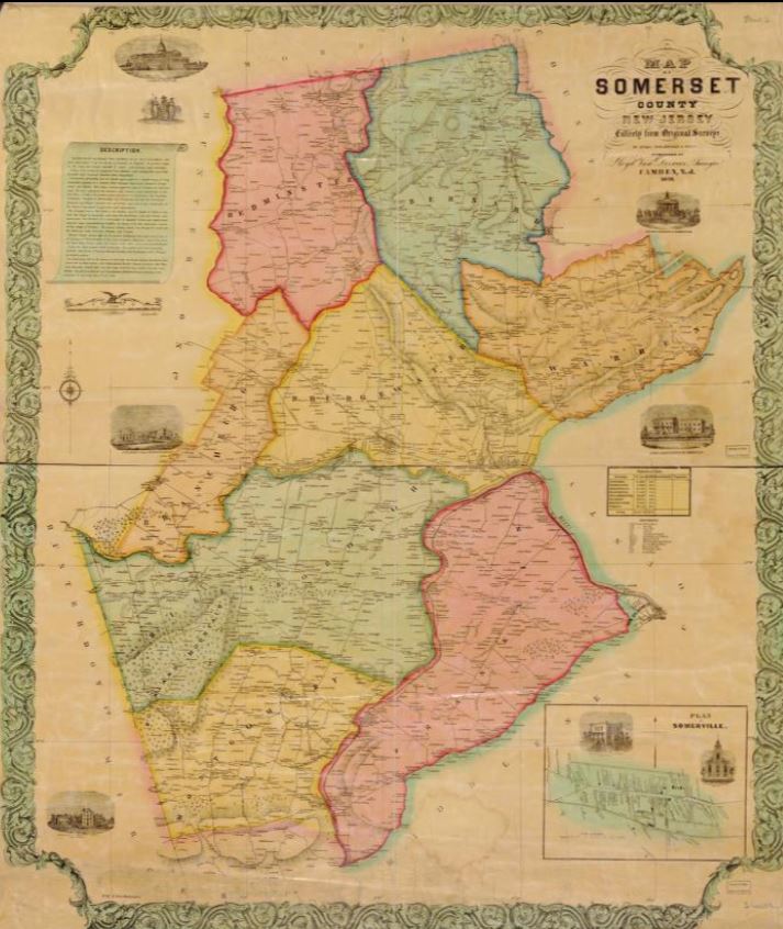
 | 1873 – HUNTERDON / SOMERSET COUNTIES FW Beers |
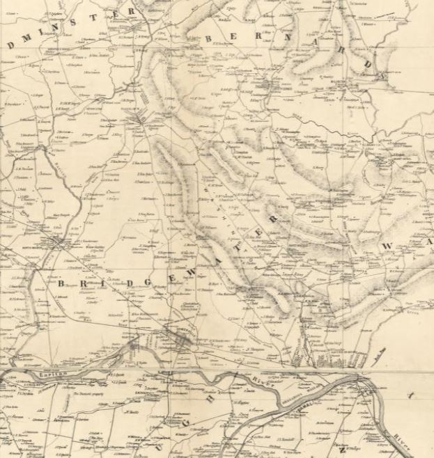 | 1850 – SOMERSET COUNTY – – Contributor: Otley, J. W. – Keily, James – Smith, Robert Pearsall – Van Derveer, Lloyd |
 | 1850 – Somerset County – Color – Relief shown by hachures. Inset : Plan of Somerville. Includes names of property owners and 7 views. LC Land ownership maps, 465 Available also through the Library of Congress Web site as a raster image. |
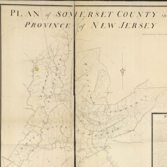 | 1766 – Plan of Somerset County in the province of New Jersey : Copied from the original by Lieut. I. Hills, asst. engr. / survey’d by Benjamin Morgan. |
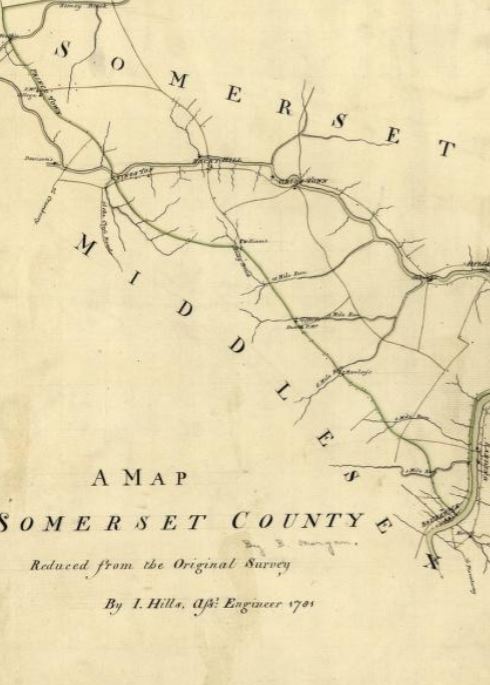 | 1781 – Somerset County Survey – John Hills (Surveyor) Benjamin Morgan (Draftsman) |
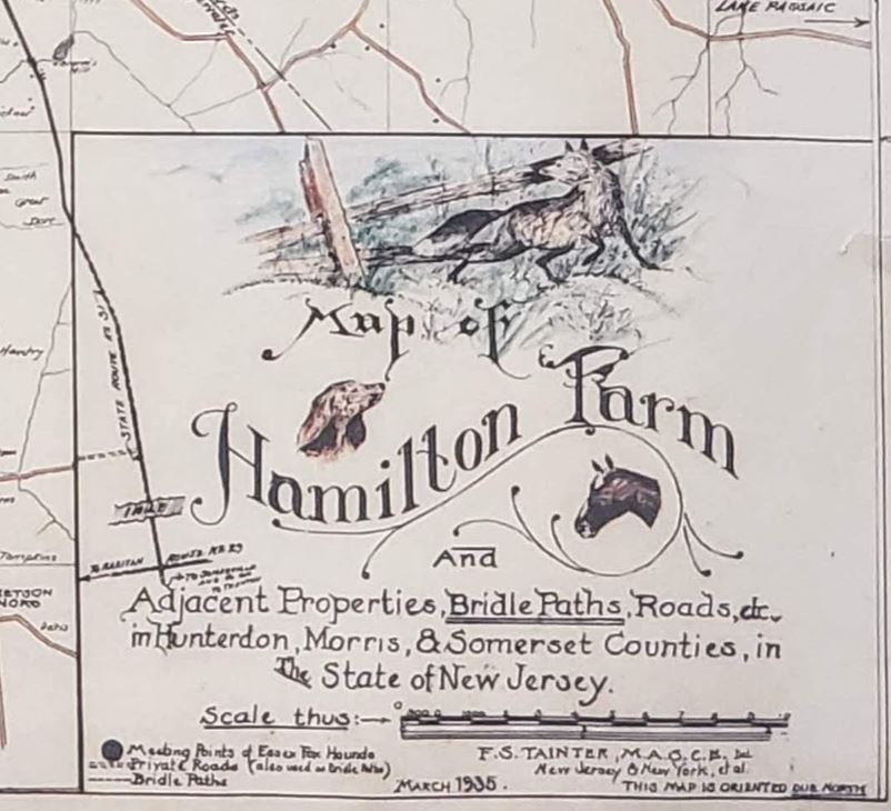 | 1935 Bridle Path Map of Somerset and Morris Counties |
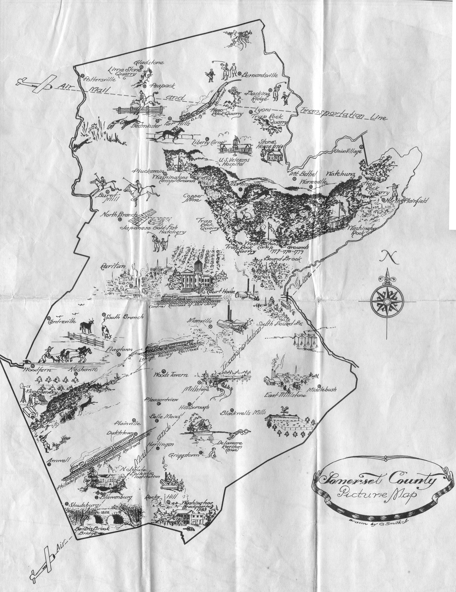 | 1940 Picture Map of Somerset County, New Jersey |
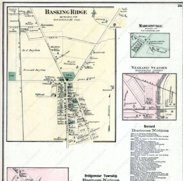
Digital Maps – Basking Ridge/Bernards Township/ Bernardsville


Digital Maps – Bedminster

Additional Map Sites
- LIBRARY OF CONGRESS MAPS
- NJ RAILROAD RETROSPECTIVE
- MAP GEEKS NEW JERSEY MAPS
- HISTORICAL FOREST MAPS
- HISTORICAL STATE FOREST & STATE PARK MAPS
- UNITED STATES – 1873
- WASHINGTON ROCHAMBEAU MAPS 1781
- RUTGERS UNIVERSITY SOMERSET COUNTY MAPS
Have a map you’d like to share?
Let us know.


