Map Identifies Historic Properties, Owners, Building Locations, Local History Including the Often Ignored Pluckemin Artillery Park

With over 2,000 hours of painstaking research and countless renderings, the landscaping firm of John Charles Smith & Associates of Far Hills is preparing to release their latest effort, a historic look back at the history of Bedminster Township. The rendering highlights historic property lines, roads, buildings, and even the lost Pluckemin Artillery Park, home to America’s first military training academy.
The map project is a culmination of over two years of effort to document landowners and landmarks of the areas past by selecting a period of time and overlaying the information that is clean and easy to understand. The team normally begins with a current tax map of the area and works backwards in time. In this case, they started with a 2004 area tax map, a 1873 historic F.W. Beers Map of the area, and another 1850 Somerset County map. The effort to create the map included countless visits to the Somerville County Clerks office, Trenton Archives, the Princeton University Library and many to the local Clarence Dillion Library in Bedminster. The Vanderveer map additions were based on a estate map of the late Dr. Henry Vanderveer’s Estate (1874) , which was provided by Bob Fox of Apgar Associates in Far Hills who maintains a number of historic records. Apgar is the firm whou orginally created the Bedminster Brady Estate and Hamilton Farm maps back to 1925
While the new map states it covers ownership from 1893-1939, there are obvious land markings that go back to the early 18th century. Peapack and Gladstone are part of the effort since those towns were still part of Bedminster Township until March 28, 1912. While the map should be completed over the next few months, the final product should be released sometime in the Fall of 2011. On a lighter note, when asked why 1939 was the representative end date, Smith noted that was the date when the Catholic Church was built in Peapack/Gladstone. “You just couldn’t leave out the Catholics,” noted Smith with a chuckle.
Local Landowner /Vanderveer History/ and the Pluckemin Artillery

For those who don’t know, the Vanderveers were one of the original settlers to the Bedminster area. The Vanderveer legacy to the Pluckemin area began when Jacobus Vanderveer made major purchases along the east and west side of the North Branch of the Raritan River in 1743. At that time he purchased 439 acres on the east side from Lewis Johnston and his wife Mary, a large landowner in the area. At approximately the same time he purchased a large tract of land on the west side of the Raritan River from Major Daniel Axtell.
The Vanderveers were one of Bedminster / Pluckemin’s largest landowners during the period. Pluckemin is the southernmost hamlet of Bedminster Township, spanning over 1,000 acres from the southern end of Bedminster Township down thru the northerern section of Pluckemin. “I wanted to visually represent the great landowners and history in one place” noted John Charles Smith, a Vanderveer House trustee and nearby resident who led the project to create the historic map.” No one’s ever done this type of work before for this area, and I thought it’d be a great history lesson.”
The Pluckemin Artillery Academy on the Vanderveer Property
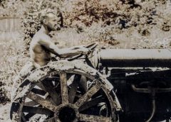
It was during the winter of 1778/1779 when the American soldiers of the Continental Artillery under the command of General Henry Knox spent the entire winter in Pluckemin. While General Henry Knox stayed at the Vanderveer House, over 1,000 Continental Artillery officers and soldiers built the famed Pluckemin Artillery Cantonment. It was there where General Knox formed the Pluckemin Artillery Academy, America’s first military training facility.
“I have to admit, this is a fantastic rendering that includes a tremendous amount of history, noted Brooks Betz, Vanderveer House Trustee who’s also working with the artifacts and history research of the Pluckemin Artillery Cantonment. ” What many people don’t realize is that the Continental Army built the famed Artillery Cantonment on the property of Jacobus Vanderveer. This is the first drawing that actually shows that the Vanderveer’s had a clear role in the success of the American military campaign.”
A version of the this map including the Vanderveer property highlighting the lost Pluckemin Artillery Cantonment area is currently on display at the Jacobus Vanderveer House in Bedminster, New Jersey.
Couldn’t Have Done It Alone
While the effort to create the drawings and images has taken over 2,000 hours at a cost over $80,000, Smith couldn’t go it alone. “You see, this is an effort that takes years to create and confirm. I have to put it down sometimes and pick it up later. It can get quite frustrating trying to put all of the pieces together.” In addition, John had the help of his landscape architecture group assisting the effort when they were in-between client engagements. Landscape Architect Brian Hirsch, along with Susan Roessner, Christopher Hewitt, and Sandra Wordsworth all had a hand with the effort.
Historic Cartographer
This isn’t the first time Mr. Smith has created a historic rendering of the area. The Bedminster/Pluckemin rendering is his second effort that followed his historic map of the Somerset Hills (Released in 2008). “This project was way more complicated then the Bernardsville Mountain Map we did a few years ago.” Smith is referring to a previous project where his team created a beautiful rendering of the historic estates of Bernardsville, New Jersey. Smith noted that the effort took three to four times the effort to create the Bedminster rendering. John and his team also won a prestigious Somerset County Historic Preservation Award for the effort. The 2010 award for educational endeavors related to the county’s history went to John Charles Smith of Far Hills for his “Map of the Somerset Hills 1893-1939.
The rendering is produced as a large lithograph on beautiful heavy stock with dimensions about 3 feet by 5 feet. The map’s scale; one inch represents 1,000 feet, so the map shows incredible detail including previous streets, property owners, building locations, and historic representation of areas that have been lost over time. “I can’t tell you how much research goes into a project like this”, noted Smith.
About John Charles Smith

John Charles Smith has been involved in many historic organizations in the area including; Chair of the Peapack Gladstone Historic Preservation Committee, Trustee of the Historic Vanderveer/Knox House, Trustee of the Macculloch Hall Museum, and member of the Historical Society of the Somerset Hills.
His firm, John Charles Smith & Associates was established in 1965, the firm has completed designs for many public gardens, commercial landscapes,and hundreds of residential projects including many historic estates, farms, woodland gardens and country homes. The firm has won national awards from the American Society of Landscape Architects, has been recognized for numerous ASLA Chapter Awards for design excellence, and received several accommodations from the prestigious Perennial Plant Association. Several of the firm’s constructed projects have been published in notable design magazines including Landscape Architecture, Garden Design and Architectural Digest; and other projects have appeared in several books on Garden Design and Landscape Architecture. Its founder and principal designer John Charles Smith is a member of the ASLA and operated his own practice for over 46 years.
Original Post: May 22, 2011
Updated: March 15, 2026