
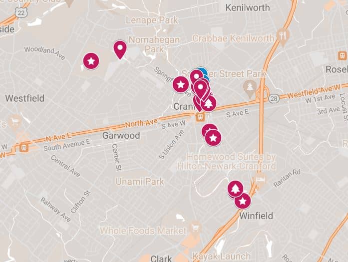
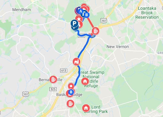
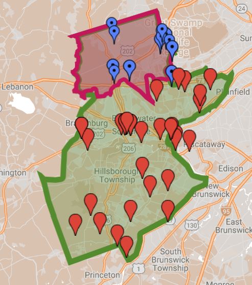
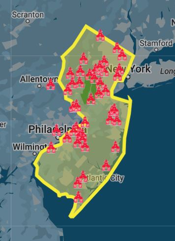
Researching Local History with Maps
As a historian, I believe maps are one of the greatest sources of information, capturing a time and place. We use these maps to research history and find buildings, families, farms, or streets. We often compare those historic maps to current maps. Then, we go on a journey to find that actual location today. Once in a while, we take our research and create maps to give perspective. #readytoremember.
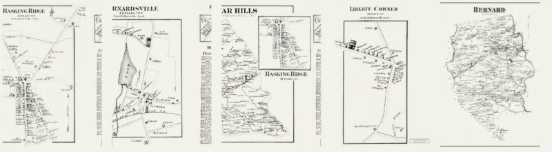
Want a Historic Map of one of 5 towns in the Somerset Hills?
Click one of the maps below to find out how to get one.
Mr Local History Google Research Maps
Mr Local History Interactive Google Maps
Digital Maps – New Jersey
 | Princeton University New Jersey Map Collection 1666-1888 also University of Michigan Map Collection See the entire New Jersey Rutgers collection – Click Here |
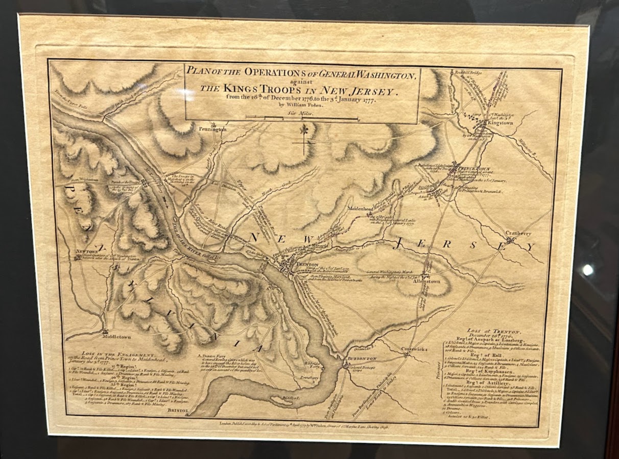 | Map Plan of the Operations of General Washington, against the King’s Troops in New Jersey, from the 26th of December 1776 to the 3rd of January 1777 It was drawn by William Faden, a noted British cartographer, and published in London shortly after these events during the American Revolutionary War. |
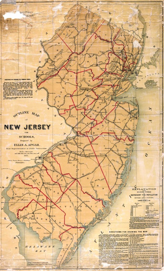 | New Jersey – 1872 Single color |
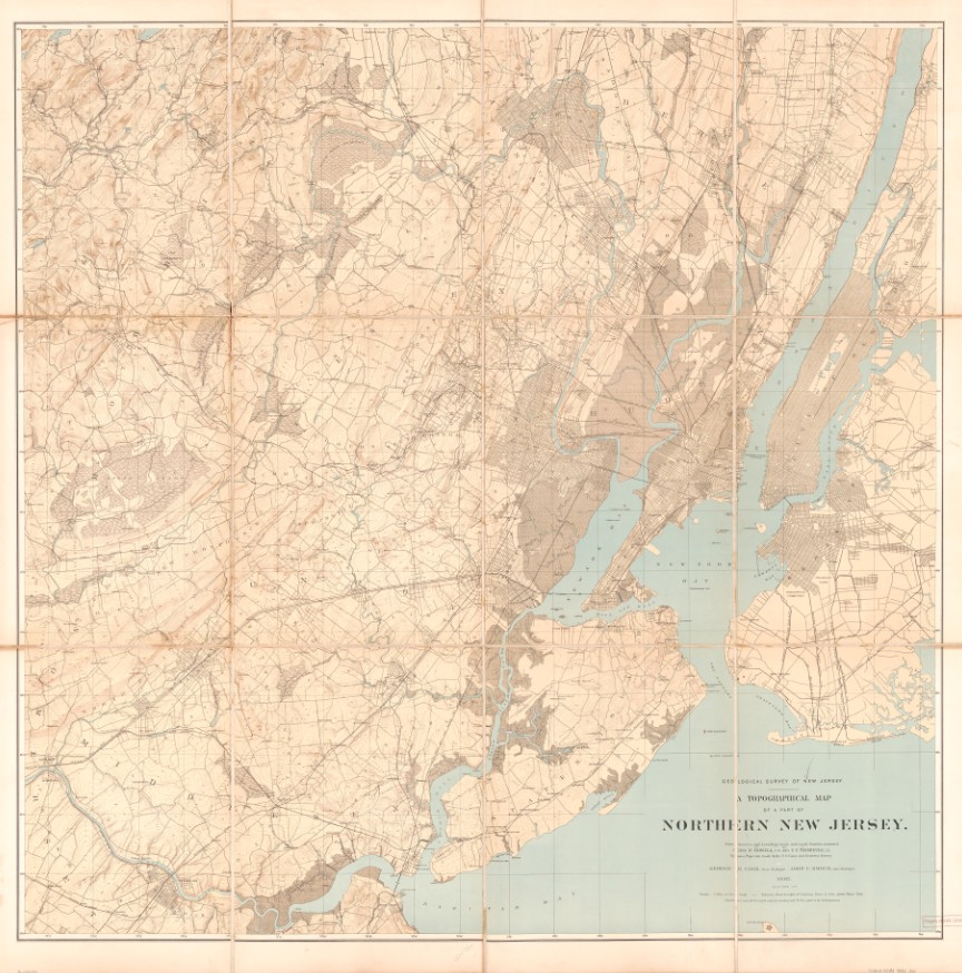 | New Jersey 1872 topographical map |
 | NEW JERSEY 1873 Color See more from the David Rumsey Map collection (Zoomable Maps) – Click Here |
 | New Jersey 1814 Color Map See the entire New Jersey Rutgers collection – Click Here |
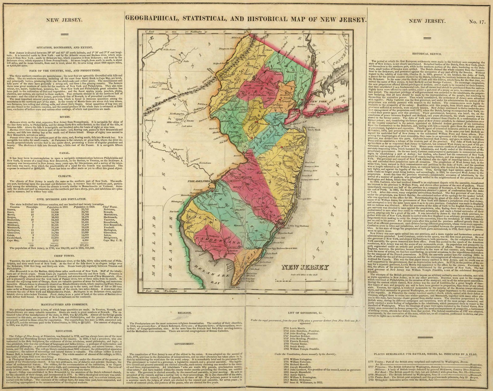 | Carey’s 1822 Geographical, Historical and Statistical State Map of New Jersey |
 | NEW JERSEY GEOLOGY – 1868 See the entire Rutgers collection – Click Here |
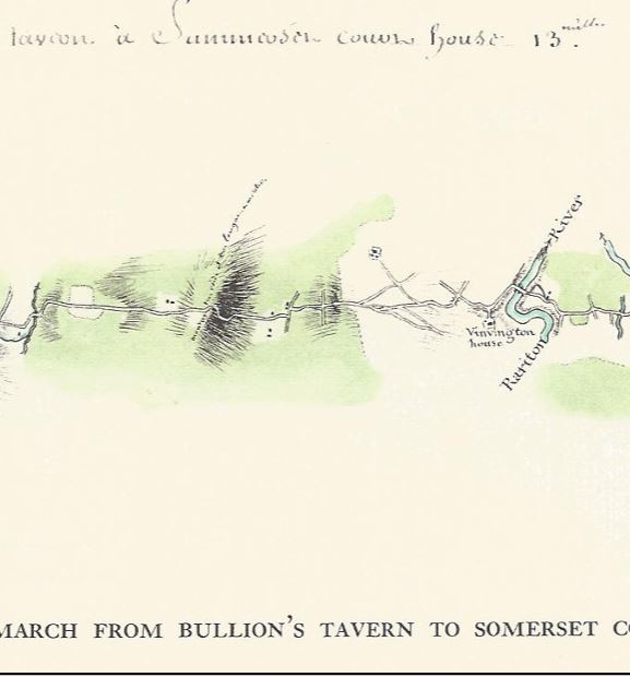
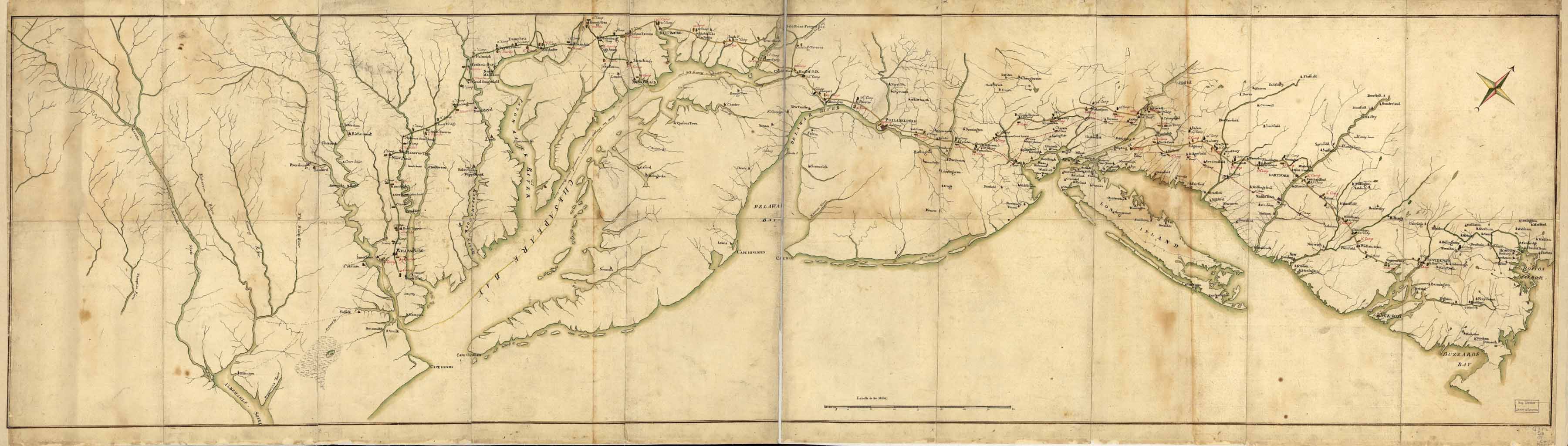 | The Rochambeau March Map – 1782 See the entire New Jersey Rutgers collection – Click Here The Rochambeau New Jersey Collection – Click Here |
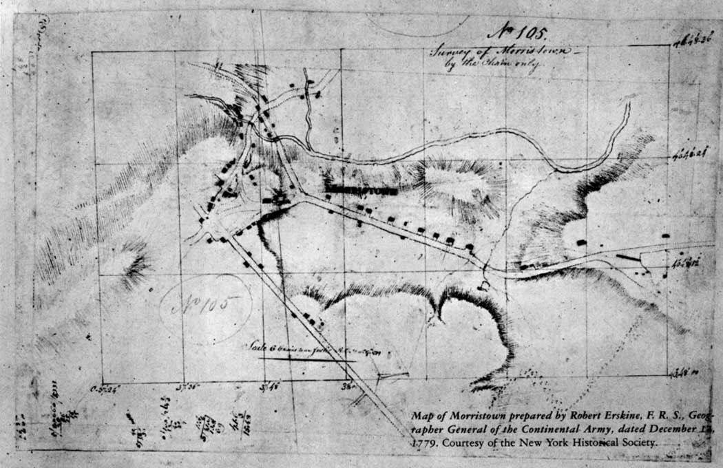
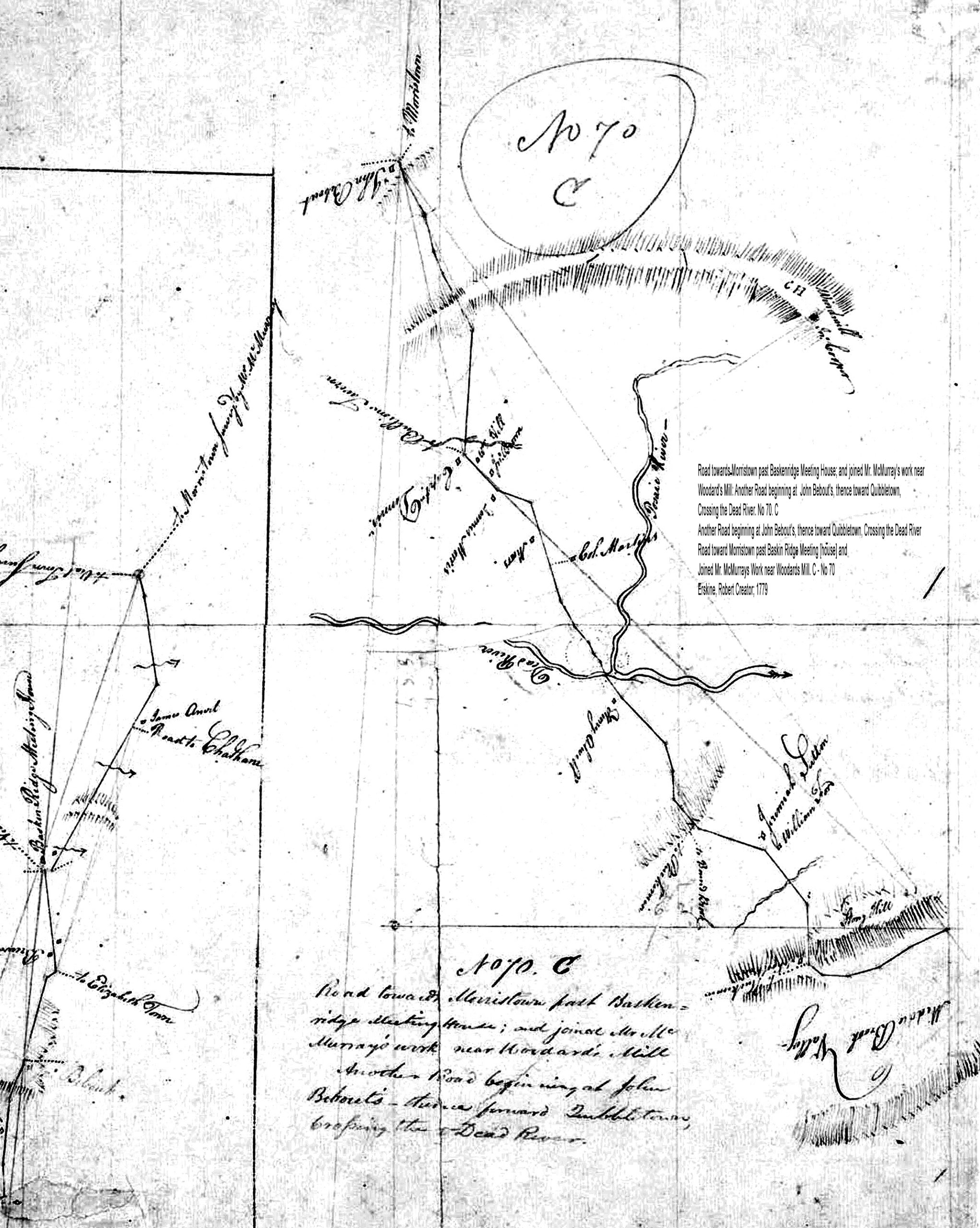
| Morristown 1779 – Robert Erskine, F. R. S., the Surveyor-General of the Continental Army |
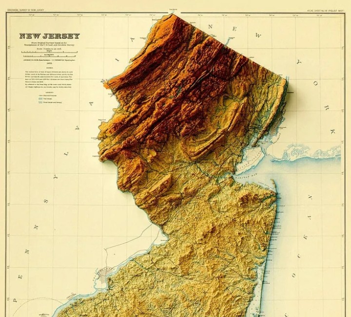 | 1888 – New Jersey Relief Map – The New Jersey Geological Survey “Historical Maps” page: “New Jersey Relief Map, 1888, 1889, 1892” — they note that the maps have been scanned in TIFF format – Various Maps in this collection. – NJ DEP Click Here |
| Map Geeks | Collection of historic digital Maps of New Jersey Jeffery’s 1776 Map of the Provinces of New York and New Jersey with part of Pennsylvania Carey’s 1795 State Map of New Jersey Compiled from the most Authentic Information Arrowsmith’s 1804 State Map of New Jersey Carey’s 1814 State Map of New Jersey Carey’s 1822 Geographical, Historical and Statistical State Map of New Jersey Finley’s 1827 State Map of Delaware, New Jersey and Pennsylvania Tanner’s 1836 State Map of New Jersey Colton’s 1856 State Map of New Jersey Mitchell’s 1880 State, County and Township Maps of New Jersey, Maryland and Delaware |
Digital Paper Maps – Somerset County, New Jersey
 | 1873 – SOMERSET COUNTY FW Beers 1873 – HUNTERDON COUNTY FW Beers |
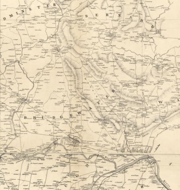 | 1850 – SOMERSET COUNTY – – Contributor: Otley, J. W. – Keily, James – Smith, Robert Pearsall – Van Derveer, Lloyd |
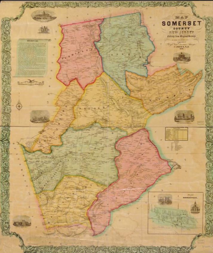 | 1850 – Somerset County – Color – Relief shown by hachures. Plan of Somerville. Includes names of property owners and 7 views. LC Land ownership maps are available also through the Library of Congress website as a raster image, and zooms in very well on the Library of Congress website. |
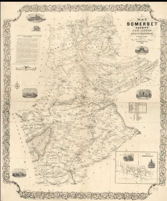 | 1850 Map of Somerset County, New Jersey: entirely from original surveys- Published by Lloyd Van Derveer, surveyor, 1850. Zooms in well. Used for Coffee House in Madisonville section of Basking Ridge. |
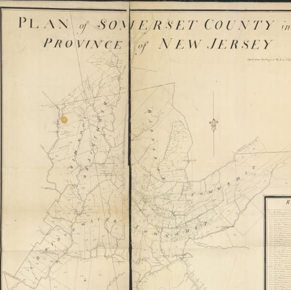 | 1766 – Plan of Somerset County in the province of New Jersey: Copied from the original by Lieut. I. Hills, asst. engr. / surveyed by Benjamin Morgan. |
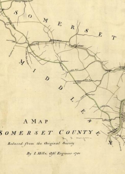 | 1781 – Somerset County Survey – John Hills (Surveyor) Benjamin Morgan (Draftsman) |
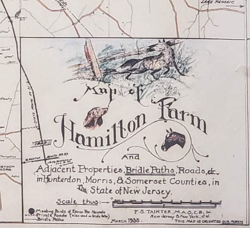 | 1935 Bridle Path Map of Somerset and Morris Counties |
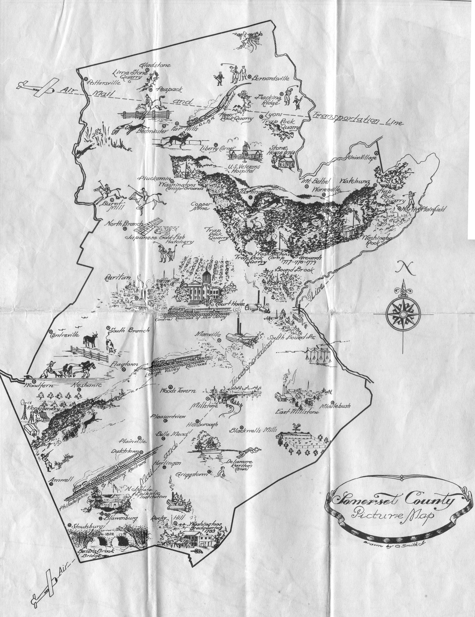 | 1940 Picture Map of Somerset County, New Jersey |
John Smith Map Collection
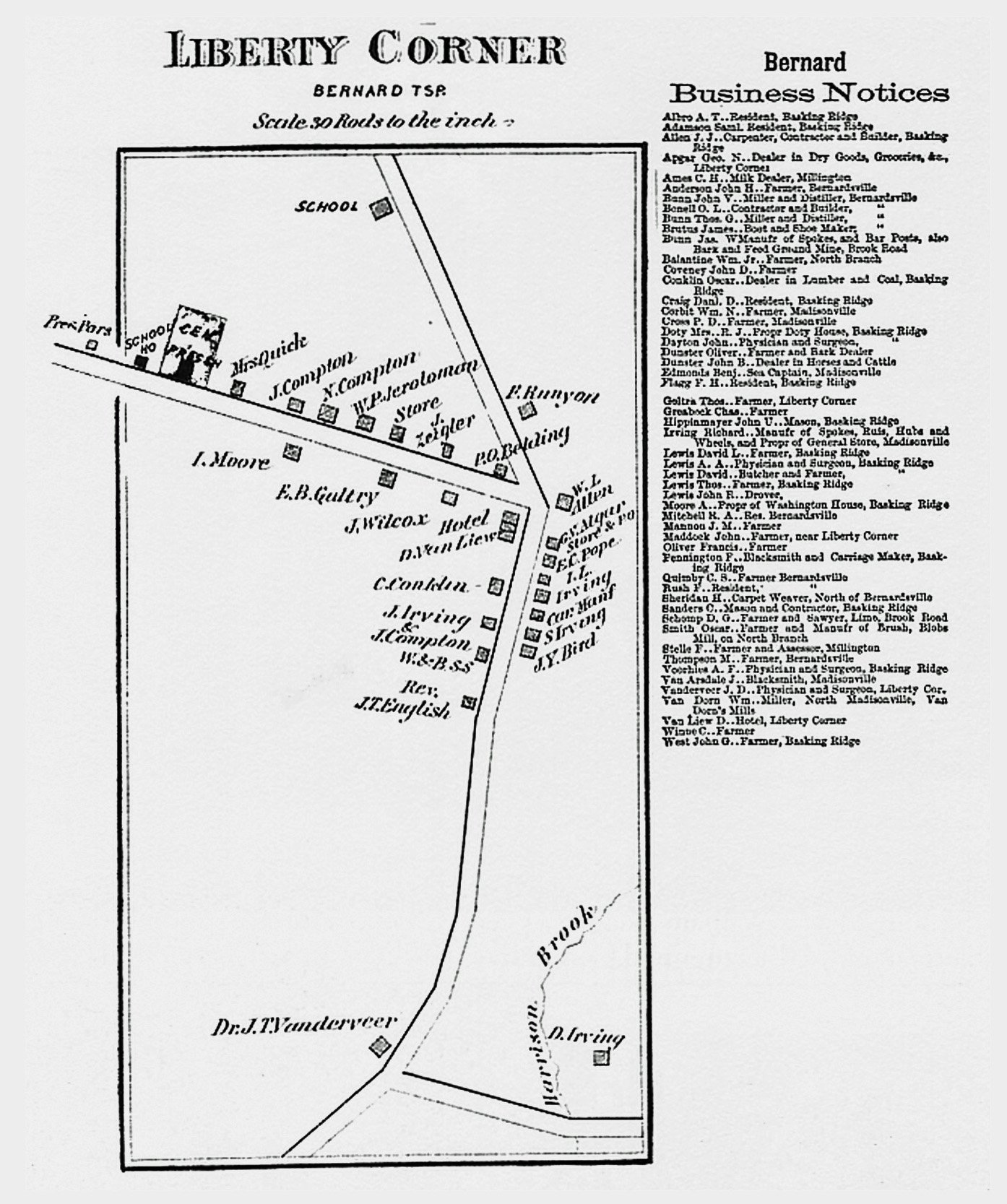
  | John Smith Map Collection (Historic Recreations) List of Available Maps covering areas from 1700-1900, including: Somerset Hills, Bernards Township, Basking Ridge, Liberty Corner, Bedminster, Pluckemin, Bernardsville, including Bernardsville Center, and more. Click Here for Information |
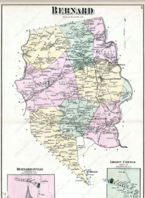
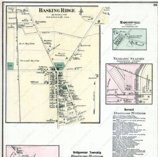
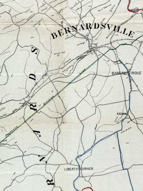
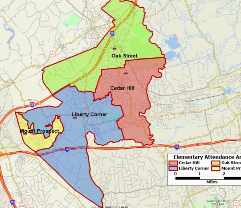
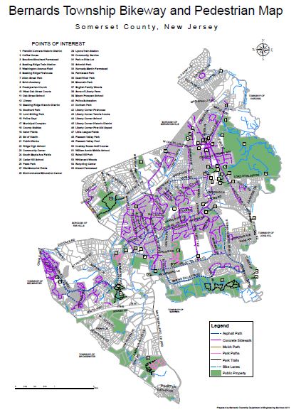
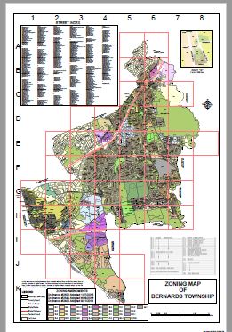
Digital Maps – Basking Ridge/Bernards Township/ Bernardsville


Digital Maps – Bedminster
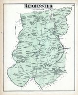 | 1873- BEDMINSTER TOWNSHIP |
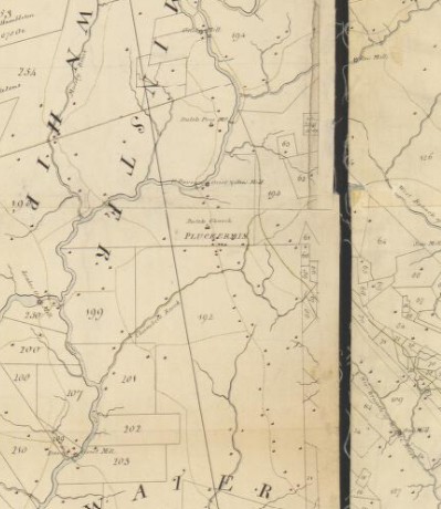 | Bedminster Township Landholders, 1766 -1766 map of Somerset County, NJ, by Benjamin Morgan and I. Hills |
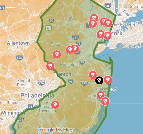
New Jersey Foodie History Interactive Maps
We love studying the history of New Jersey food – diners, sandwiches, bars, and more.
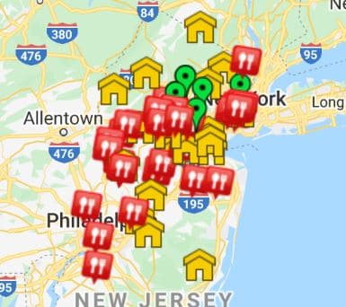
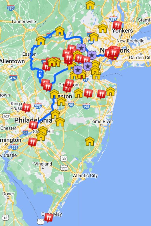
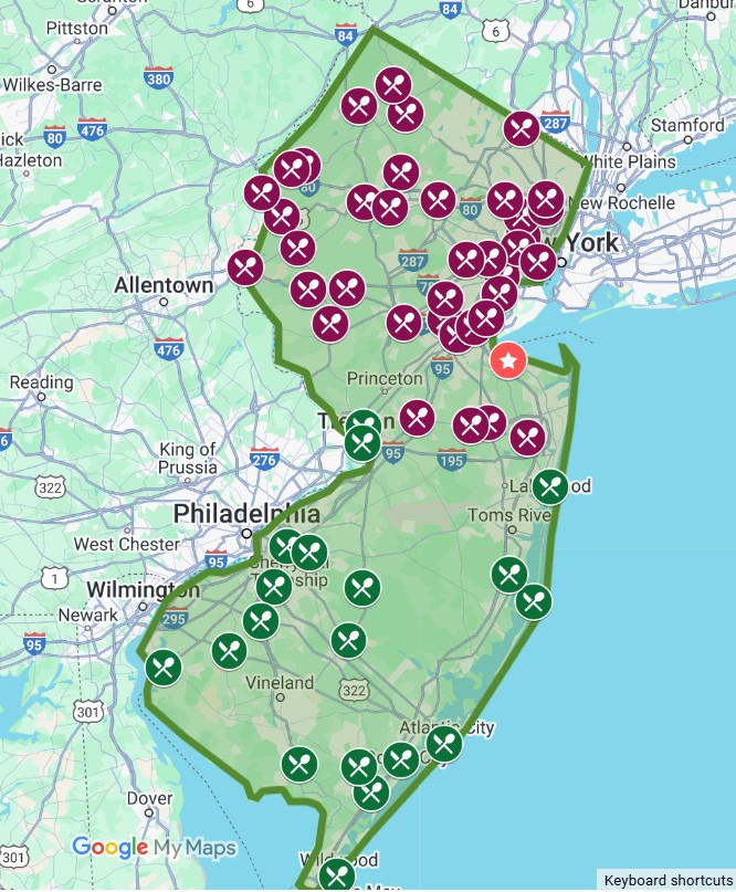 | Mapping New Jersey’s Most Iconic Diners |
 | Jersey Comfort Food – Mapping The Best of the Best! |
 | Finding New Jersey’s Giant Pizzas |
 | Distillers in New Jersey Map – Tell us when a new distillery fires up. |
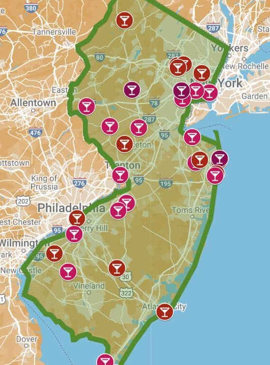
 | The Only Map of New Jersey Dive Bars |
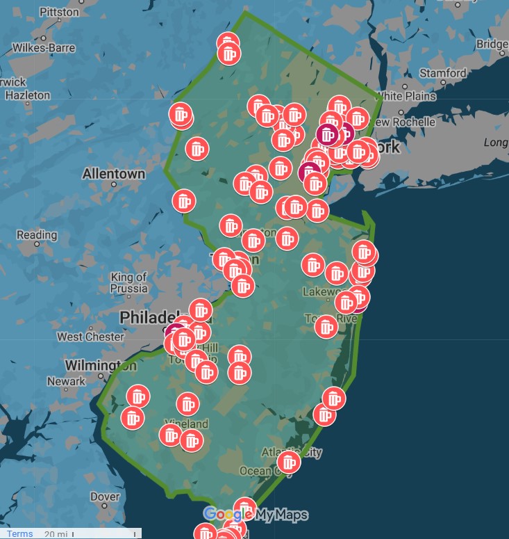
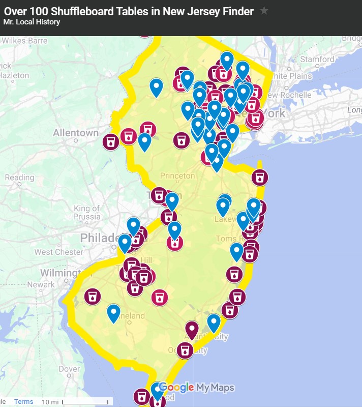 | Jersey’s History with Bar Room Shuffleboard |
Additional Map Sites
- LIBRARY OF CONGRESS MAPS
- NJ RAILROAD RETROSPECTIVE
- David Rumsey Map Collection (Zoomable Maps) – Click Here
- MAP GEEKS NEW JERSEY MAPS
- HISTORICAL FOREST MAPS
- HISTORICAL STATE FOREST & STATE PARK MAPS
- UNITED STATES – 1873
- WASHINGTON ROCHAMBEAU MAPS 1781
- RUTGERS UNIVERSITY SOMERSET COUNTY MAPS
Do you have a map you’d like to share?
Let us know.
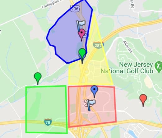
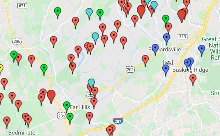
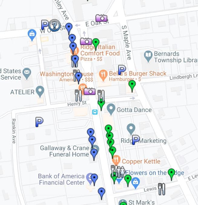
MLHP Research with Maps
(Typically Google Digital Interactive Maps)
There is a wealth of history to be learned from a map. We have historic maps and interactive maps embedded in many of our stories, and we try to list that research here. If you’re looking for something specific, try our search feature.
Sir Francis Bernard Honored With American Town Names
Views: 5,781 Sir Francis Bernard’s Legacy Carries On as Towns Honor the Royal Governor of New Jersey and Massachusetts In 1758, Francis Bernard, originally from Lincolnshire, England, was appointed Governor of the province of Nova Caesarea (New Jersey). He packed…
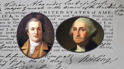
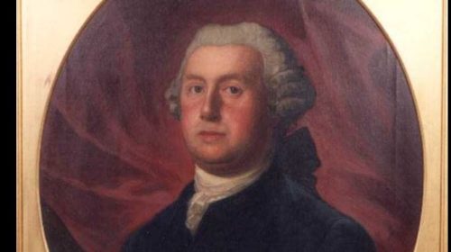
Lord Stirling Deep Dive Series
Views: 3,478 Some called him William, others called him General. Some even called him Lord Stirling. Whatever you called him, William Alexander, aka Lord Stirling, was one of the most interesting people of the Revolutionary War. The Mr. Local History…
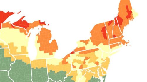
Day Trips – Four Historic New Jersey Fall Locations You Must See
Views: 8,210 The 2025 Fall Foliage Map is the ultimate visual planning guide to the annual progression of leaf change. While no tool can be 100% accurate, this tool is designed to help travelers better time their trips to maximize their chances…

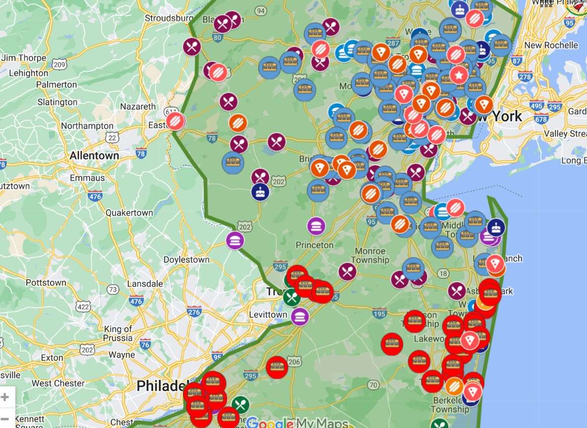
The History of Burgers and Mapping the Best Burgers in America
Views: 26,926 Start This Journey with 2 minutes of #burgerporn. Enjoy as we did! Who doesn’t love a good burger? Ah, yes, even the statement opens the door for interpretation. How big, ketchup or not, steamed, fried, broiled, with lettuce—the…
Bernardsville’s Lost Dayton Home, Orchards and Mount Airy Nursery
Views: 2,238 UPDATE:Another Dayton family discussion came up…. we couldn’t refuse the query. MLH Introduces Ezra Dayton and the Dayton Families The name “Mount Airy” first appears in printed atlases and maps as early as the 1870s–1880s, when the hill…
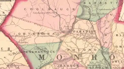
Pocono Pines and Lake Naomi Area – Map Collection Showcases History
Views: 2,880 I’ve been creating a series of memories and researching the history of Lake Naomi, Pocono Pines, and the greater Pocono Mountains area. While some call me a historian, I’m more of a researcher who shares what I find,…

Meet the Historians Series
Views: 3,491 Featured individuals include longtime resident and historian Ruth Thomson (with ties to the Peapack-Gladstone area) and her son, Barry Thomson, along with other local history advocates dedicated to preserving the region’s cultural heritage. Bedminster’s Dutzie Robie, Bernardsville’s Marion Kennedy and…

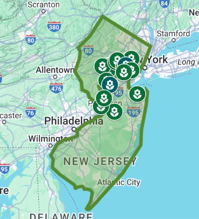
Garden State’s Top Historic Gardens and Estates
Views: 6,981 April 14th is National Garden Day, so make sure you get out there and enjoy our Garden State’s beauty (and history) While the Mr. Local History Project typically focuses on historical research, stories, and events, we figured one…

The New Jersey Historic Wooden Village Keepsake Collection Keeps Expanding
Views: 26,507 The MLH Project is proud to be the exclusive reseller of the New Jersey Historic Wooden Keepsake Collection, created by the world-famous Cat’s Meow Village. Made in the USA!!! NEW FOR 2025 The New Jersey Historic Wooden Keepsake…
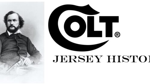
Col. Samuel Colt Got His Start in Paterson, New Jersey
Views: 9,119 Starting in 1836 in Paterson, New Jersey, Samuel Colt’s revolver is one of the 10 most influential inventions EVER produced. The Colt Paterson revolver was the first practical revolving-cylinder handgun, and it was made in Paterson, New Jersey. For years,…

Jersey’s History with Bar Room Shuffleboard
Views: 22,078 Isn’t it interesting how history becomes a part of history? Take, for example, pay phones. When you were using them, you never thought about it, and then they’re gone and not just gone……totally gone. Then you see them…

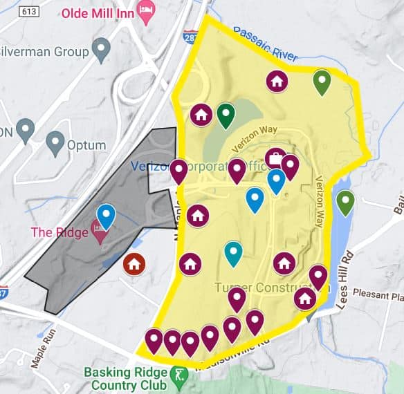
Retrospective: Building AT&T Headquarters Basking Ridge
Views: 16,781 As with all Mr. Local History retrospectives, we often update the post when we learn stories and are sent photos from our community. We will continue to expand this piece as information becomes available. If you have any stories…
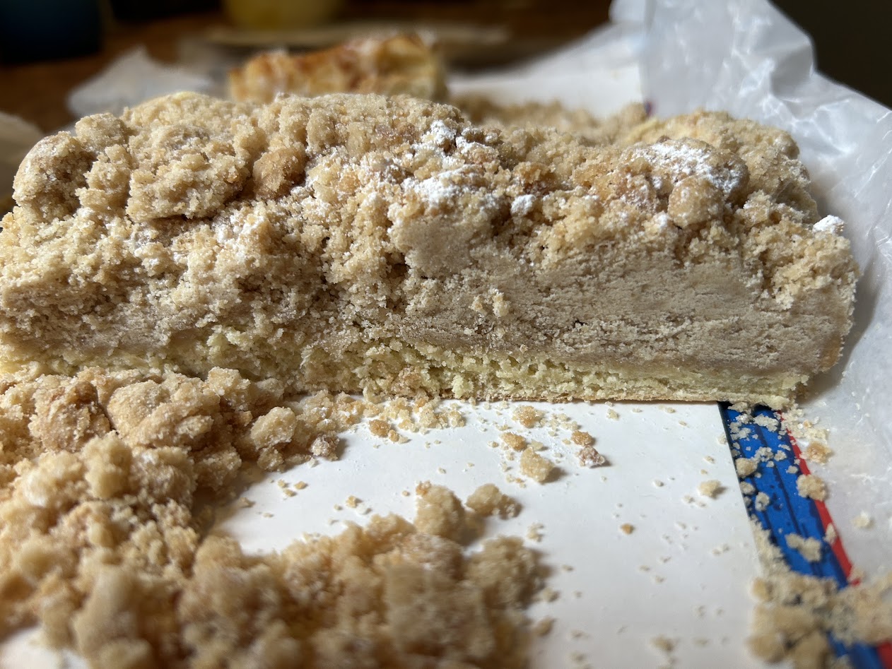
Best Crumb Cake in New Jersey – Discuss Now
Views: 93,418 Maybe we’re taking this too seriously, but we’ve been searching for bakeries serving New Jersey’s best crumb cake. If you’re not a fan of the cake, you might want to leave now because we’re really going to get…
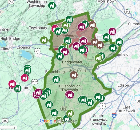
New Jersey Hills are Alive with Distilling History
Views: 11,992 Distilling in Central New Jersey New Jersey has a deep history of distilling spirits that goes back to colonial times. The Somerset Hills is an area in central New Jersey’s Somerset County grouping six similar towns, villages, and…
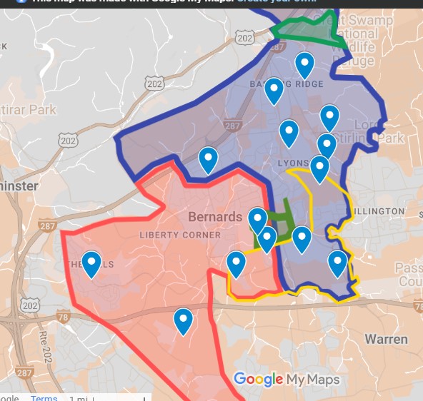
Where is West Millington, Lyons and Madisonville Sections of Bernards Township
Views: 5,519 NOTE: As with all Mr. Local History retrospectives, we often update the post when we learn stories and are sent photos from our community. We will continue to grow this piece as information becomes available. Mr. Local History Project…
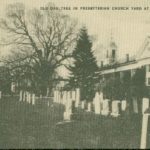
Local Cemetery History Research
Views: 1,130 There is a wealth of history to be learned from a cemetery. We have a rich genealogy embedded in many of our stories, and we strive to describe other facts, analytics, and stories about those who make their…
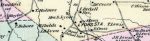
Maps That Share Our Research – Mr. Local History Project Collection
Views: 2,274 There is a wealth of history to be learned from a map. We have historic maps and interactive maps embedded in many of our stories, and we try to list that research here. If you’re looking for something…
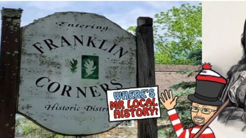
Franklin Corners and William Childs Williamsburg-esqe Vision
Views: 8,712 Tucked in the northernmost section of Bernards Township, New Jersey, along the Passaic River lies a small historic district. If you drive through it, you’ll notice the area’s rich history, marked by its grist mill and restored barns.…
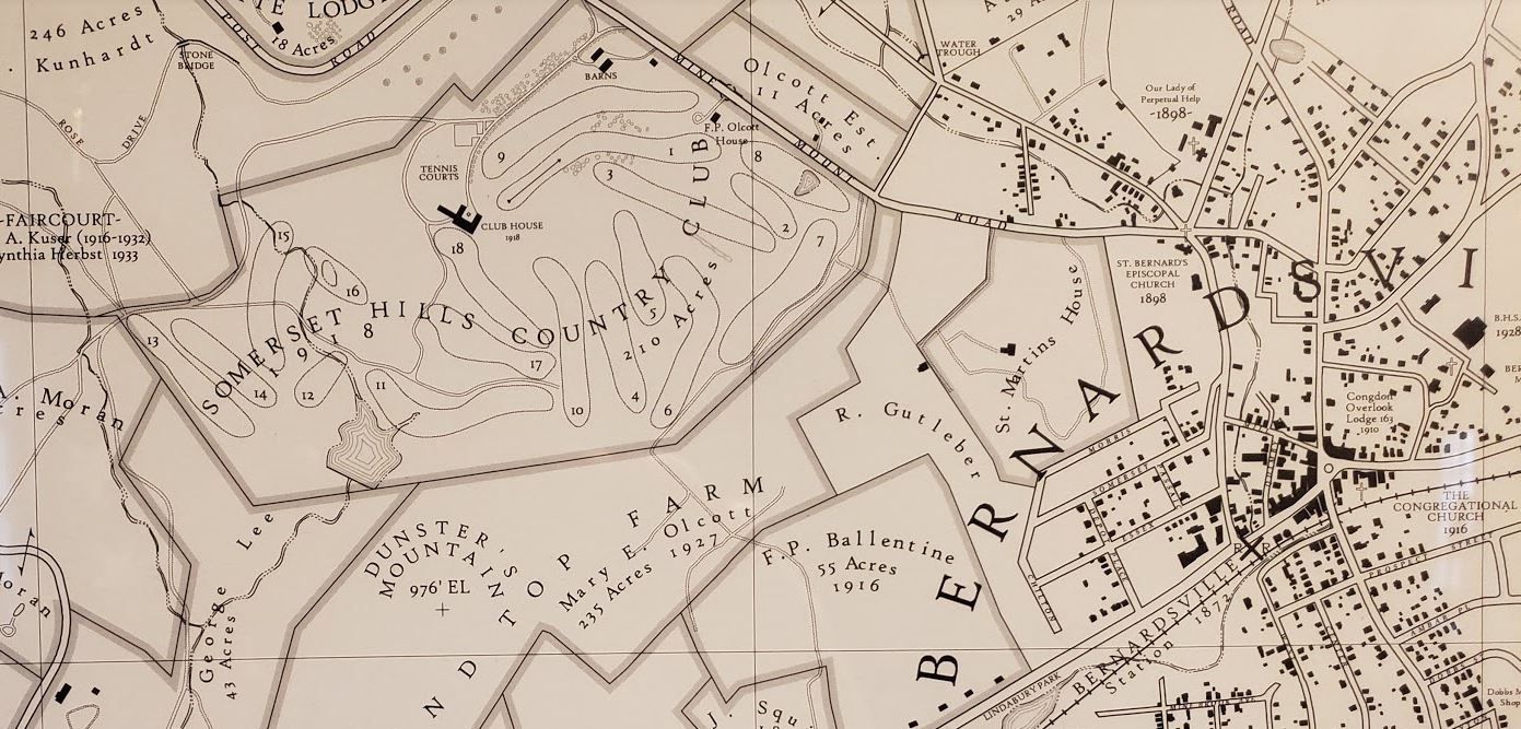
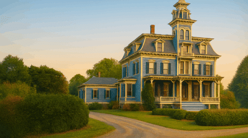
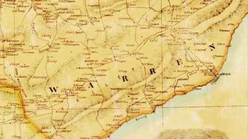
Grand Mansions and Historic Estates Mapped in New Jersey’s Somerset Hills
Views: 40,188 Many people have asked why you post all this history stuff on the area you’re calling the Somerset Hills. Well, call it passion. Call it intrigue. Call it local awareness. I think the main reason is that the…
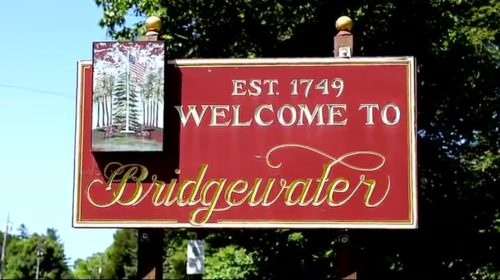
Remembering 5 Historical Sites in Bridgewater, New Jersey
Views: 7,311 Bridgewater is the second largest town by population in Somerset County, with 45,977 residents according the 2020 Census. Its population boomed in the 1970s-1990s, but has been an important part of the County and State since the Revolution.…

Bernards Township Charter Day Streetfair Memories
Views: 3,066 Bernards Twp. 2025 Charter Day is A MEMORYBut You’re Early for 2026 🙂 Weather Forecast Stop by the Mr. Local History Booth #89 on Henry Street Just outside the Washington House Side Entrance Watch the South Finley Livestream…
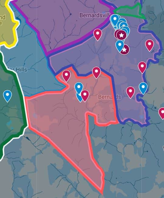
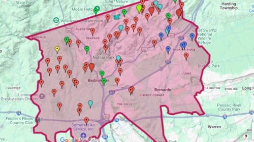
History of Housing Developments in Bernards Township
Views: 11,339 Interactive map showcases Bernards Township development history. Source: Mr. Local History Bernards Township has a long history of being a sleepy rural town. Then, the US built the Lyons VA, and everything changed as the population grew. Then…
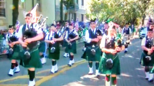
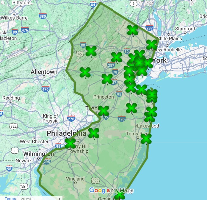
Gotta Love the Irish in Jersey – The History and All the Parades
Views: 2,032 Quick History – Irish Immigration to New Jersey By the mid-19th century, Irish immigration from Ireland to the United States surged, mainly due to the Great Irish Famine (1845-1852), which drove hundreds of thousands of Irish people to…

Mr. Local History Knows The Top 18 Daytona 500 Destinations to Hit During Speedweeks
Want to go to the #Daytona500 Speedweeks and feel like you know where to go? Here’s 20 years of experience all in one place where we’ve highlighted the top 15 Daytona spots to hit during Speedweeks. We’ve loaded THE BEST.

There’s a lot of History in These 100+ Jersey Dive Bars
Views: 7,464 The term “dive bar” originated in the United States in the 1880s and was initially used as a derogatory term. It referred to drinking establishments often located in basements or below street level, where patrons would “dive” down into the…
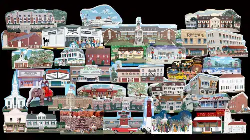
The Exclusive New Jersey Historic Wooden Village Keepsake Collection
Views: 14,994 The MLH Project is proud to be the exclusive reseller of the New Jersey Historic Wooden Keepsake Collection, created by the world-famous Cat’s Meow Village. Made in the USA!!! The New Jersey Historic Wooden Keepsake Village Collection The…
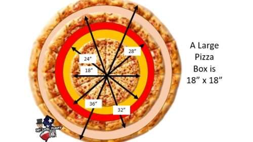
Finding New Jersey’s Giant Pizzas
Views: 3,669 People keep asking us why a non-profit is dedicated to researching New Jersey history and building food maps. The short answer is that history has what we call threads. We start researching one thing, which leads to another.…

VOTE for Jersey’s #1 Pizza Place
Views: 939 Many critics say New Jersey might have the best pizza places in America. Being from New Jersey, we can’t disagree. Why there would be any Dominos, Pizza Huts or Pappa Johns is beyond comprehension. Now it’s your turn…
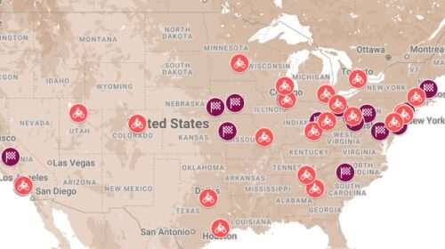
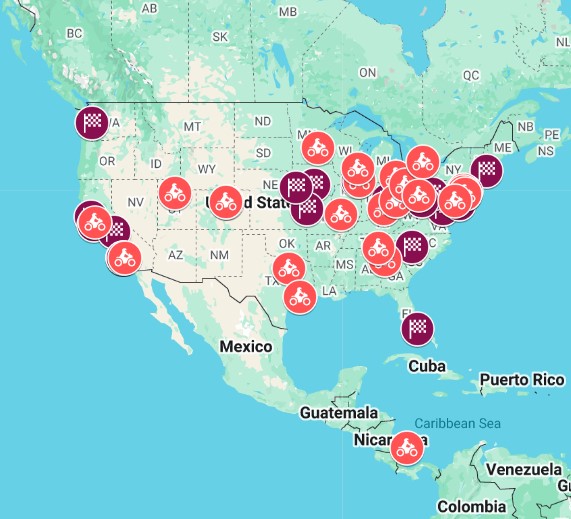
Lost Motorsport Board Tracks Across America – Mapping Them All
Views: 5,042 As a huge motorsports fan, this topic came up with a few of our researchers who can’t let it go! While the Mr. Local History Project normally focuses on New Jersey history, they had to discover more once…
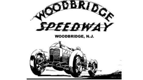
1928 – Woodbridge Speedway – World’s Fastest 1/2 Mile Track
Views: 4,868 This is a tale about auto racing legends of the early 1920s, known as daredevils and speed freaks, who traveled to a tiny new track built outside New York City in the small town of Woodbridge, New Jersey.…
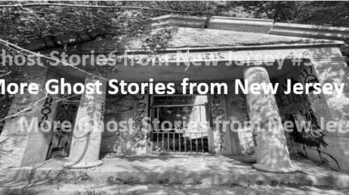
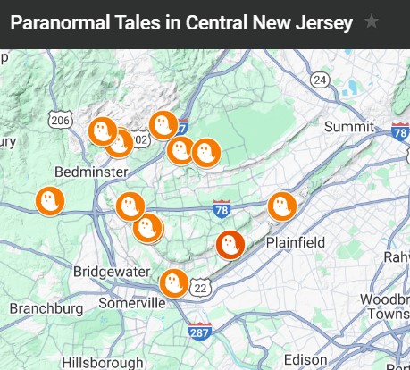
Haunted Tales From Central New Jersey #3
Views: 2,688 Believe it or not, the dead are alive in central New Jersey, especially in northern Somerset County. The question is not whether they are real or not, but rather whether they are disturbing or friendly. As we share,…
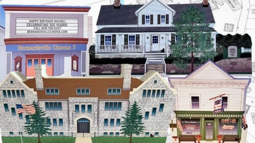
Bernards Township/Bernardsville Historic Wooden Village Keepsake Collectibles
Views: 4,137 Congratulations, Basking Ridge and Bernardsville, on being the foundation for the New Jersey Historical Wooden Village collection, a group of over 40 Jersey collectibles. Each keepsake brings awareness to historic area icons created by the world-famous Cat’s Meow…
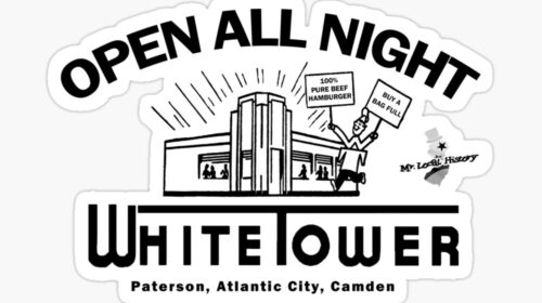
Retrospective: White Tower Hamburger System – In Search of New Jersey Locations
Views: 4,204 As with all Mr. Local History retrospectives, updates are made to this post when we learn additional information. We will continue to expand this post as information becomes available and our readers suggest additions. Mr. Local History Research Team Mr.…
IF you build it, they will come. Sorry, we love maps and use them for our research all the time. Could be a cartoon map or a map from 1750, we have an entire map collection cause they tie back to history. Go for it.