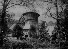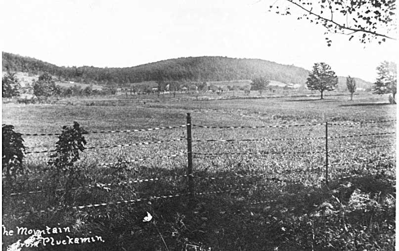
In the early 1700s, German Lutherans settled around Pluckemin and established one of the region’s first congregations. By 1715, they had built a small log church on what is the Second Watchung Mountain, known also as Pigtail Mountain, east of the village along Mount Prospect Road above Washington Valley Road. The congregation called it Im Geberge, meaning “On the Mountain,” and it later became known as Raritan in the Hills Lutheran Church.
The German Palatines, from the war-torn Rhine region, brought their Lutheran faith to the hills of Bedminster, New Jersey. Sometime around 1715, they built the Im Geberge church “on the mountain,” the first organized German congregation in the area. The Lutherans erected a log church on a 100-acre tract donated by Peter Sonemans, a wealthy landowner of East Jersey. This remote hilltop served both as a place of worship and a burial ground for the local German community. It has also been noted that before the Germans arrived, the Lenape Indians, who dominated the area, had a burial site in the same general area.
The mountain church was eventually dissolved by the German Palatines as Dutch settlers from New Amsterdam began moving into the Bedminster area, prompting the German congregation to establish new communities farther west. They relocated to New Germantown, later known as Oldwick, in the Tewksbury area of Hunterdon County. Records from 1850 show the land at the former mountain church site was owned by J. Kline (see map).
The first church in New Germantown, now Oldwick, was the Zion Lutheran Church, founded by similar German Palatine settlers in the early 1740s. It would replace the earlier Im Geberge “church on the mountain” near Bedminster, and became the first Lutheran church in Hunterdon County, now one of the oldest in New Jersey.


Gods Acre Remembered
Thought we’d share some of our research from a 1914 edition of the Somerset Quarterly Magazine and the Lutheran Church of Raritan in the Hills:


Side Note:
The J. F. Vanderveer shown on this 1850 Otley–Van Derveer–Keily map references Rev. John F. Vanderveer, who accepted a call to the Bedminster (Reformed Dutch) Church and served there until 1865, placing him exactly in that area in the 1850s. He is a direct descendant of the Vanderveer family that owned the Jacobus Vanderveer House to the north.
Then the Hills Development Came
The quiet site returned to public attention in November 1998, when construction crews from Toll Brothers, developers of The Hills community, uncovered a forgotten cemetery containing more than two dozen graves, later determined to hold up to 66 individuals.
Following archaeological documentation, the remains were respectfully reinterred in a single grave at the Pluckemin Presbyterian Church cemetery. The surviving headstones were moved for safekeeping to the Oldwick Lutheran Church, though historians continue to advocate for the original markers to be returned and displayed at the consolidated burial site in Pluckemin, restoring a visible link to the area’s early German Lutheran heritage.
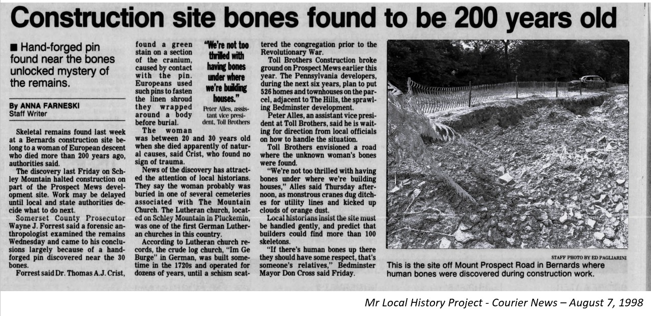
The remains of 66 individuals were reinterred on February 14, 1999, in the cemetery of the nearby Pluckemin Presbyterian Church in the village. Others in the cemetery include the Eoffs, Captain James Leslie, Malieks, and Moelichs (Mellicks), all prominent Pluckemin residents in the 1700s.
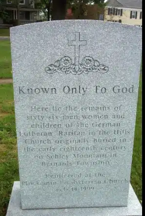
Known Only To God (Inscription)
Here lie the remains of sixty-six men, women, and children of the German Lutheran Raritan in the Hills Church, originally buried in the early eighteenth century on Schley Mountain in Bernards Township. Reinterred at the Pluckemin Presbyterian Church, February 14, 1999
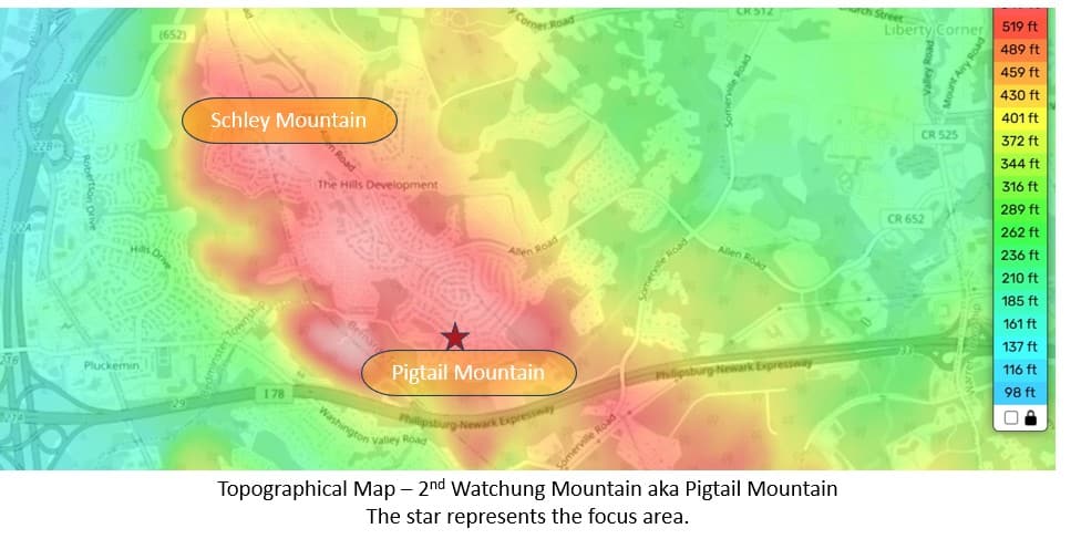
Pigtail Mountain
While doing our research, we did find another interesting tie to the area. Maps often referenced the same area just east of the Pluckemin Village in Bedminster, on the hillside where the German Cemetery, also known as Pigtail Mountain, once stood. Much of the Pigtail Mountain ridge east of the village, around Mount Prospect Road and above Washington Valley Road, is within The Hills area and nearby subdivisions. As a result, parcels there are private and include land developed by Toll Brothers and HOA holdings. The 1998 cemetery find at the old Im Geberge site occurred during the Hills development work, confirming private control in that section.
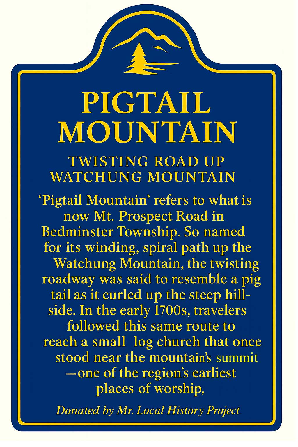
PIGTAIL MOUNTAIN
TWISTING ROAD UP WATCHUNG MOUNTAIN
‘Pigtail Mountain’ refers to what is now Mt. Prospect Road in Bedminster Township. So named for its winding, spiral path up the Watchung Mountain, the twisting roadway was said to resemble a pigtail as it curled up the steep hillside. In the early 1700s, travelers followed this same route to reach a small log church that once stood near the mountain’s summit—one of the region’s earliest places of worship.
Donated by Mr. Local History Project.
Many will know the area as the location of the Microwave and Cell Phone Tower on the Mountain, visible from Route 78 while traveling Eastbound around the Route 78/287 junction.
Pluckemin Revolutionary War Beacon Site
One last historical tidbit to share about the same hillside, back during the Revolutionary War, General Lord Stirling (William Alexander) was put in charge by General Washington to construct a wooden signal beacon atop this same mountain in 1779.