Take an aerial journey meandering down Mine Brook on the Meadowbrook farm area. Relax and enjoy.
Most people in Bernardsville go about their business every day, never really wondering what it was like when Bernardsville was still part of Bernards Township. Then, one day, a group of people was looking at an old B’ville map and noticed a giant pond right in the middle of it. Everyone just thought it was Nervine Pond next to the Bunn Mill town hall and moved on. But that’s not the case. At one time, there was a massive pond right in the middle of downtown Bernardsville. We had to know more.
The brook that starts up off Bernardsville’s Claremont Road runs down the Bernardsville mountain, meandering slightly under 5 miles west along Mine Brook Road, through the Mooreland Farm in Far Hills, eventually emptying into the North Branch of the Raritan River just before the AT&T facility. The brook is named after the mountain ore mines on Bernardsville Mountain, hence the name “Mine Brook.” What many know as US Route 202 is the Mine Brook Road, which runs along the Mine Brook.
The Mysterious Mine Brook Mill Pond in Bernardsville
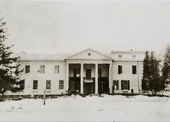
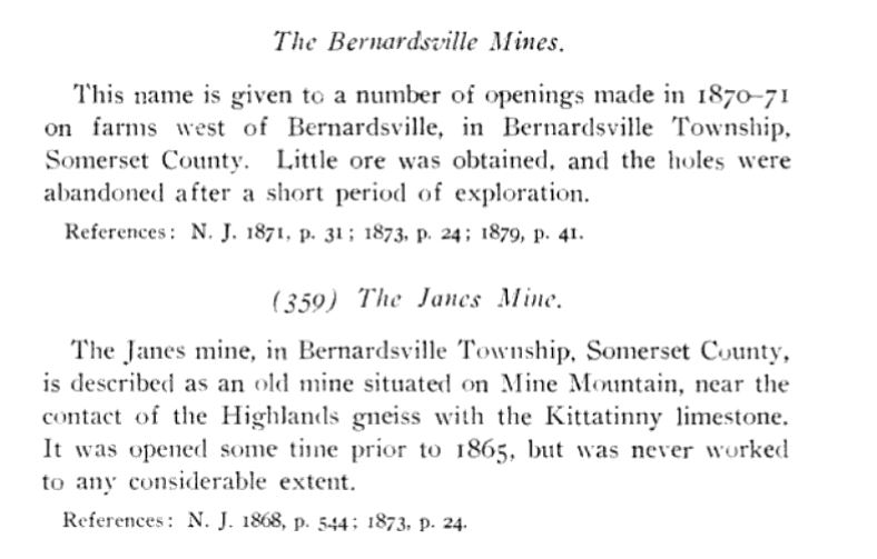
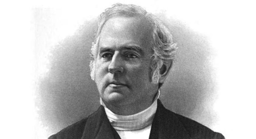
To better understand our Mine Brook mill pond, you must look back at Bernardsville’s history. Before Bernardsville became the “Mountain Colony,” the Bernardsville Mountain was known as “Mine Mountain.” Thought to be rich with iron ore, a man named Bishop Janes decided to stake his claim at the top of the mountain on present-day Mendham Road by purchasing several mines on the mountain. Janes knew that the mines had been busy servicing the independence cause during the Revolutionary War. Janes, now recognized as the “Father of the Bernardsville Mountain,” built what later became George Seney’s Somerset Inn, the summer playground for the rich and famous that changed the landscape forever.
Our first stop was the Spinning History Room at the Bernardsville Public Library.
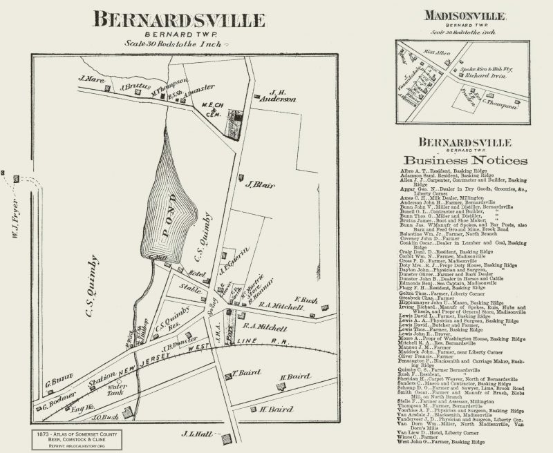
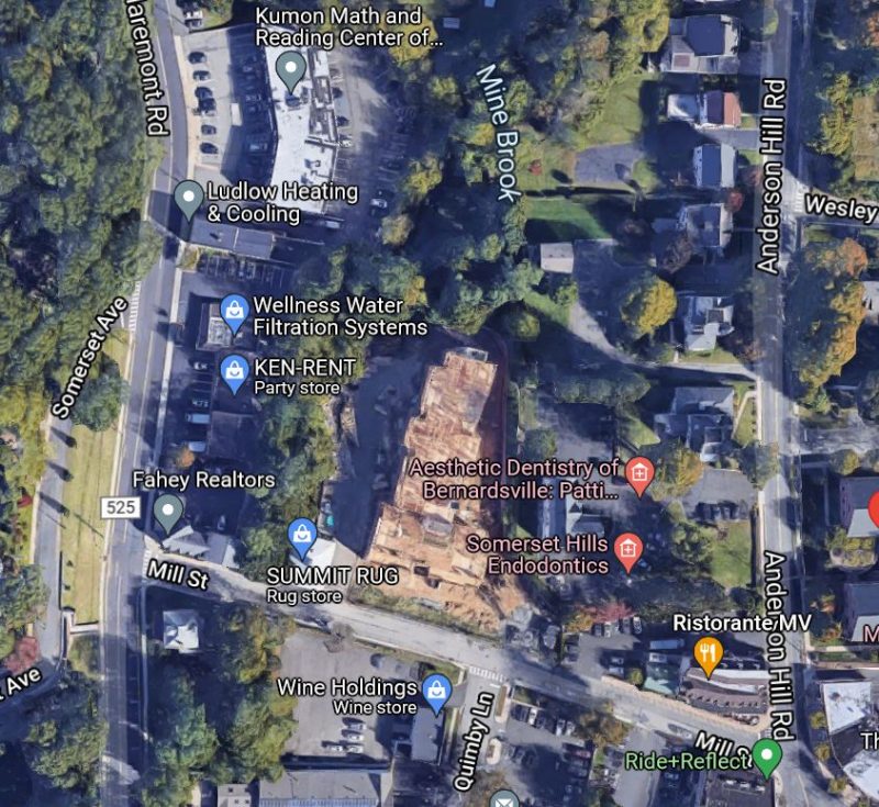
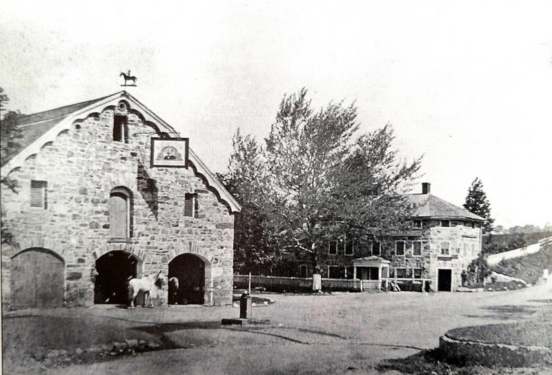
Photo Gallery & Mine Brook Connections
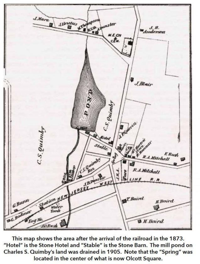

What Happened to that Mine Brook Pond on the Map
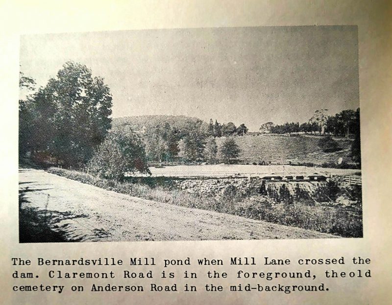
As we look back at history, we see that a convergence of issues led to the loss of the Bernardsville Mill Pond. The most prominent thought is that the electric turbine installed at the dam became ineffective and obsolete. Once that became outdated, there was no need for the turbine; hence, there was no need for water to run the mill. It was also noted that the pond had become shallow due to silt build-up.
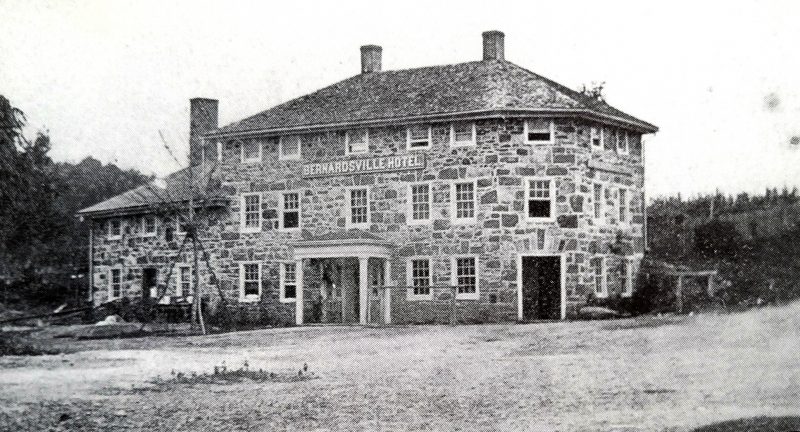
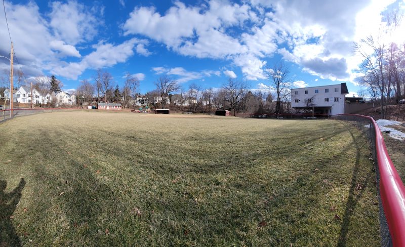
The easiest solution to draining the pond was removing the dam along Mill Street. And that’s exactly what happened. Most likely, in 1905, when the town decided to build Claremont Road alongside the pond, they broke the dam below Mill Street to drain it. The result was additional homes, a field, a park, and a ball field. The mill, however, did last until the 1970s before being demolished. Now, there are more townhomes and condos.
Mine Brook Flooding
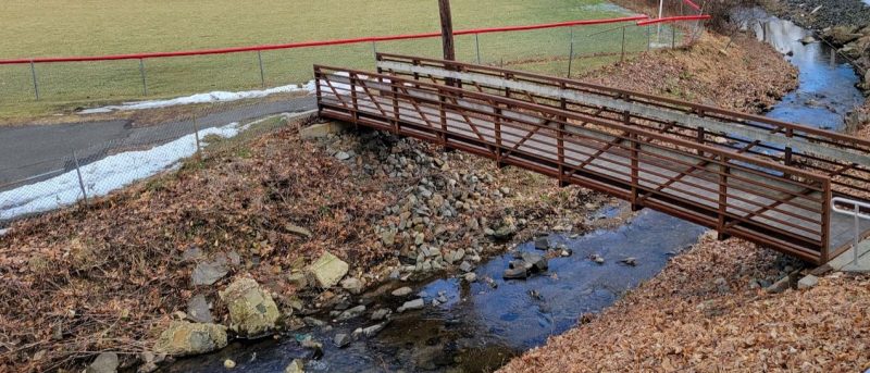
As with any water tributary, flooding is a reality along Mine Brook’s banks. As the brook winds down the Bernardsville mountain, occasional flooding is just par for the course. As you look at the area’s topography, floodplain areas exist around the current ball field area (the former Bernardsville Mill Pond). The elevation levels in two spots: Mill Street first, then Mine Mount Road alongside Quimby Lane. As the brook passes under the railroad tracks, the Mine Brook slowly meanders for miles through the Meadowbrook Farm and a large flat plain along the valley between the Bernardsville Mountain and Pill Hill, traveling west towards Far Hills.

What’s interesting is that Mine Brook has no flood drainage or piping along its path. It is just a way of life for residents.
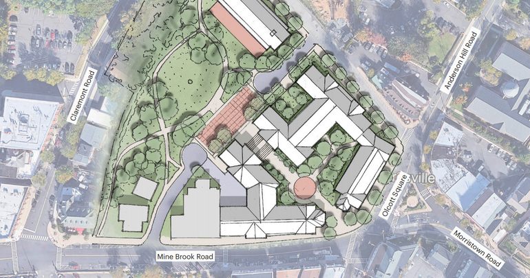
Only history will tell how Quimby Lane will fare against the quiet Mine Brook and its momentary concerns over the development of the Quimby Lane project. Bernardsville’s proposed Quimby Lane redevelopment plan from 2021. As you can see, Mine Brook still flows quietly nearby. The original vision has not disappeared: a mixed-use, walkable “European style” downtown district around Quimby Lane, Olcott Square, Mill Street, Claremont Road, and the train station area. Plans included housing, affordable units, retail/restaurant space, pedestrian improvements, public spaces, and Mine Brook frontage enhancements.
More Bville MLH Posts
History doesn’t Write Itself without your support.
Support our nonprofit that supports your local history with a contribution.

Like elite athletes at their peak, our history journalists are highly trained in the art of digging up history. It takes skill, endurance, and pure will to deliver interesting stories of the life and times of the great history in New Jersey and the areas you love.
And that all costs more than just our time and energy. So we’re asking you to support us with more than your attention.
If you enjoy reading stories like these from our volunteer writers, please contribute today.
You’ll help power the dedicated team behind this story and hundreds of others like it.
And your contribution is TAX DEDUCTIBLE, as we are an IRS-recognized 501 (c) (3) nonprofit educational charitable organization.